Tutorial
Go from an airport to your first aircraft path in a few simple steps.
1. Getting started
- Open SteerSim in your browser.
- Choose Sign in in the top bar.
- Enter your email.
- Tick I agree to the Terms and Privacy Policy.
- Choose Send magic link, then open the link from your email.
Signing in is optional. Without it, your projects stay in this browser.
2. Load an airport
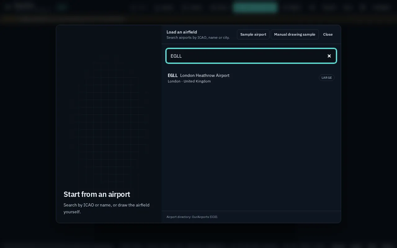
- Choose Start from airport (it opens by itself the first time).
- Type an airport code or name, such as EGLL.
- Select the airport in the results.
Taxiways, runways and stands load from OpenStreetMap over satellite imagery. Sample airport is a quick way to practise.
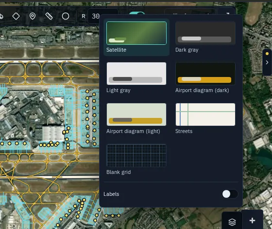
Satellite is the default background. To change it, open Basemap (the layers button at the bottom right of the map). If an airport has no mapped taxiways, SteerSim offers Assisted layout, Draw on satellite or Blank grid.
3. Use the command bar
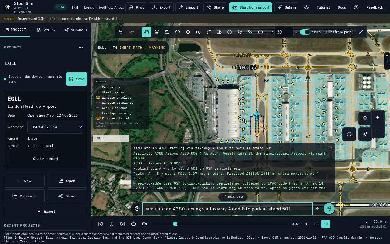
Type what you want in plain words and SteerSim draws the route, runs the checks and plays the aircraft.
- Click the command bar under the map.
- Type or paste one of the prompts below.
- Press Enter.
At London Heathrow (EGLL):
simulate an A380 taxiing via taxiway A and B to park at stand 501: taxis an A380 along taxiways A and B into stand 501.push back A388 from stand 521 to twy Y: pushes an A380 back from stand 521 onto taxiway Y.park B738 at stand 521: parks a Boeing 737-800 on stand 521.check clearances: runs the clearance checks again on the current path.switch to FAA: changes the clearance rules to FAA (switch to ICAOchanges them back).
At OTHH:
Taxi A380 from twy C to stand V7: taxis an A380 from taxiway C to stand V7.
Taxiway and stand names must exist at the loaded airport. If a name isn't found, the bar tells you and suggests real ones.
4. Pick an aircraft
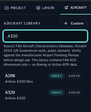
- Open the Aircraft tab in the left panel.
- Search by code or model, such as A320.
- Select the aircraft in the list.
A common narrow-body is selected to start with.
5. Draw a path
- Zoom in to the taxiway you want to check.
- Choose Polyline (L) in the toolbar above the map.
- Click points along the taxiway centreline.
- Press Enter to finish the path.
- Choose Play animation (or press Space) to watch the aircraft move.
The swept path appears as soon as the path is finished. Keep Snap on so points land on the centreline.
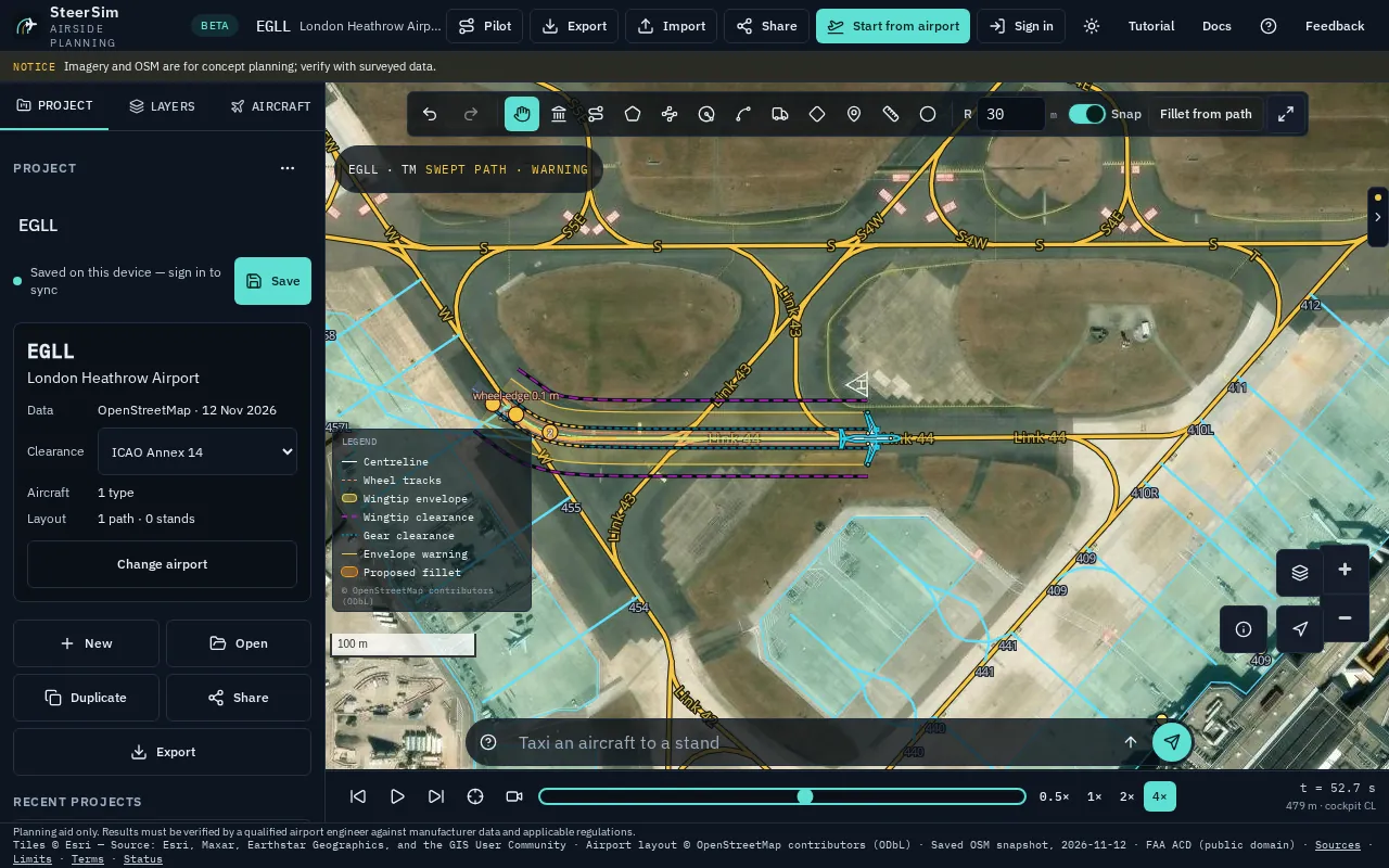
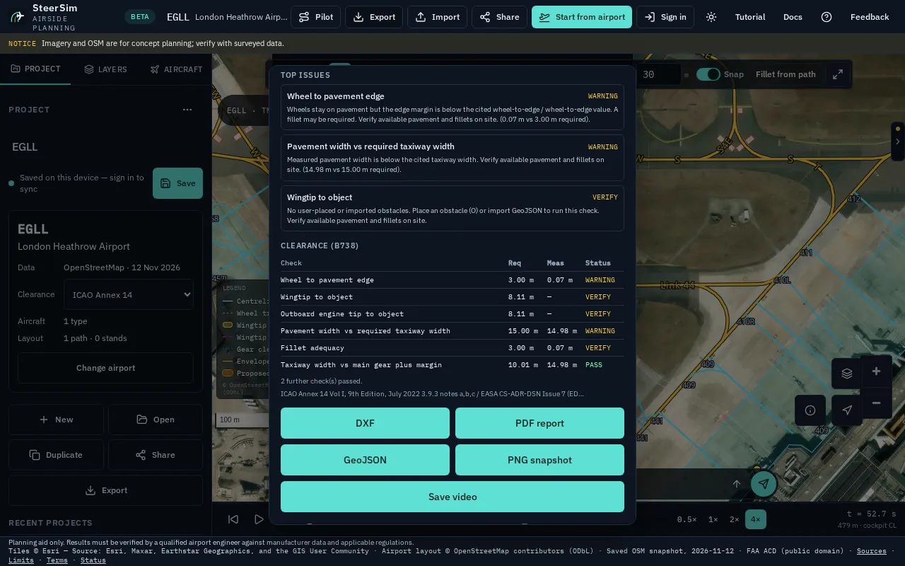
6. Read the clearance results
- Open the inspector with the arrow on the right edge of the map.
- Scroll to the findings list.
- Compare Required with Measured for each check.
Green is a pass, amber a warning and red a fail. Chainage tells you how far along the path it happens. VERIFY means a check needs more data, such as an obstacle you place with Obstacle (O).
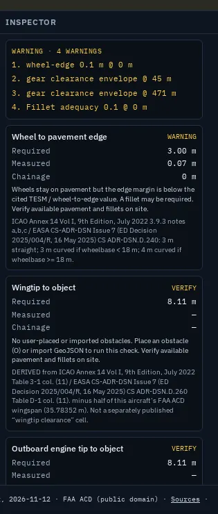
7. Try Pilot mode
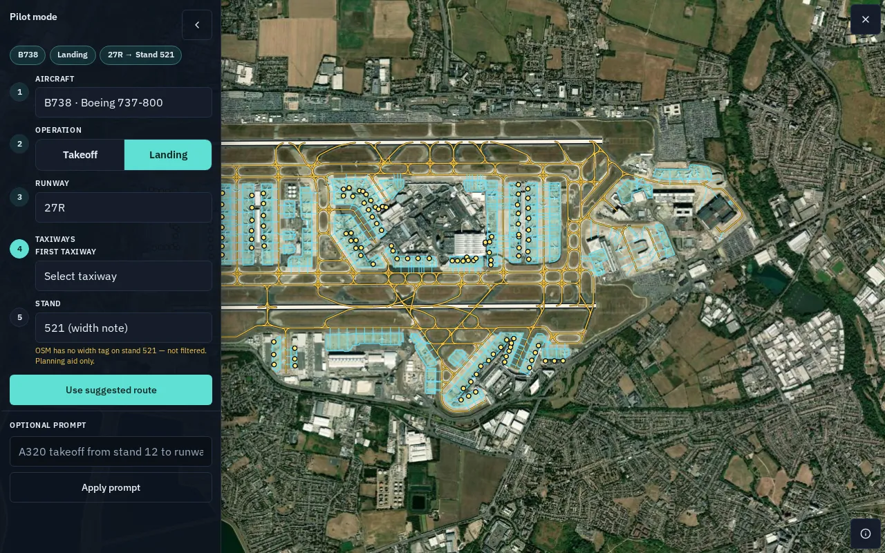
Pick a taxi route from lists instead of drawing it.
- Choose Pilot in the top bar.
- Check the Aircraft.
- Choose Takeoff or Landing.
- Pick the Stand and Runway.
- Choose Use suggested route.
To set the taxiways yourself, use First taxiway and Add taxiway instead of step 5.
The replay starts on its own. Use the bar at the bottom to pause, scrub or change speed. If the bar hides, tap the map or move the pointer.
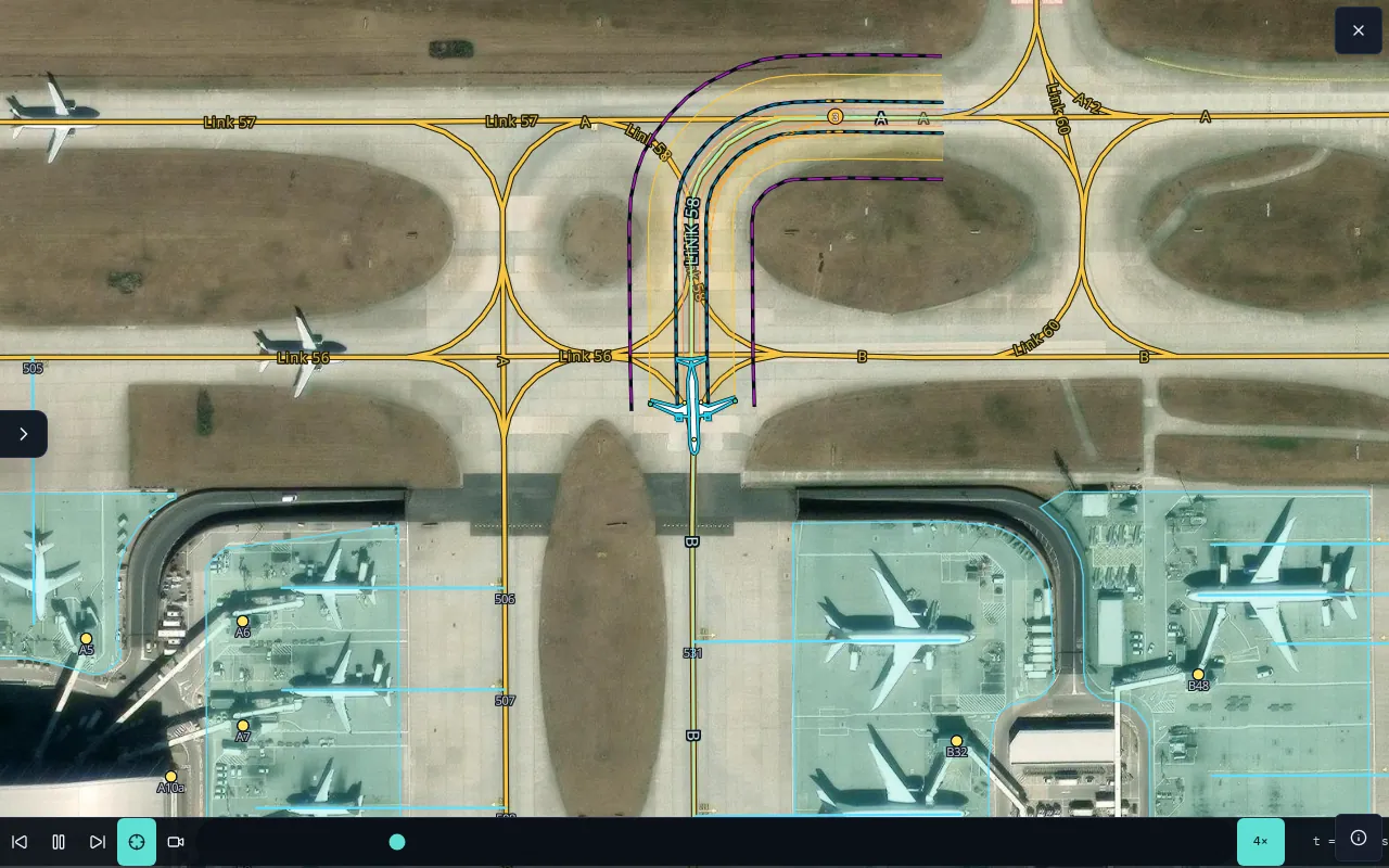
If a route can't be completed, choose Change selection or Use manual simulation. Choose × at the top right to leave Pilot mode.
8. Save and export
- In the Project tab, type a project name.
- Choose Save.
- Choose Export in the top bar.
- Pick PDF report, DXF or Save video.
PDF is a report of the checks, DXF opens in CAD, and the video records the simulation. Share creates a read-only link once you're signed in.
Quick tips
- Undo fixes the last change.
- Press the up arrow in the command bar to reuse a previous prompt.
- Switch between FAA, ICAO and Custom rules with Clearance in the Project tab.
- Press ? for all keyboard shortcuts.
- See ready-made Examples in the Project tab: Path, Pushback, Fillet and Stands.
Screenshots use cached OpenStreetMap data (© OpenStreetMap contributors, ODbL) and Esri World Imagery (Esri, Maxar, Earthstar Geographics and the GIS User Community). Aircraft dimensions: FAA Aircraft Characteristics Database, public domain. Data sources and licences.